Plan A was to head for Queen’s Head yesterday, but it was a pretty grim morning, snow and sleet showers driven on a strong wind. There was a weather window in the afternoon, but by that time we were doing other stuff.
Today was supposed to be better anyway, and the weatherman didn’t let us down. The wind is still with us, but at least there was no wet stuff in it.
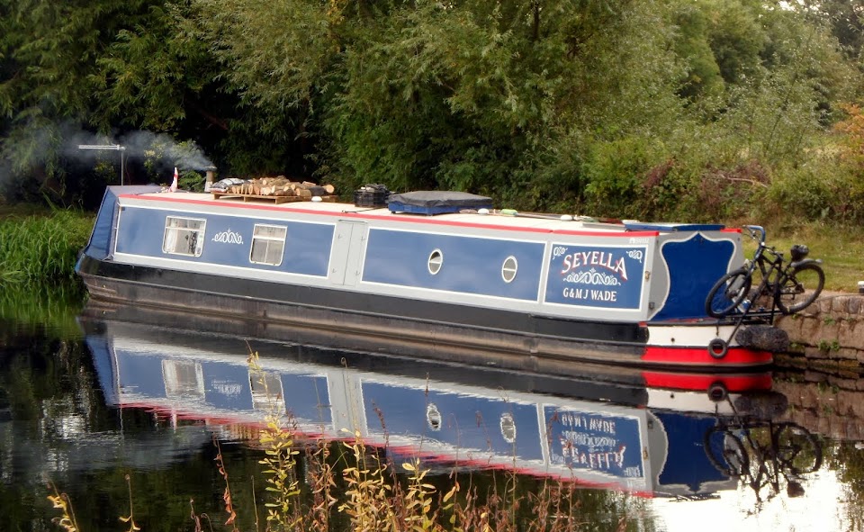
Where we were moored is the junction where the Weston Arm branched off to Weston Lullingfields. It’s only a short stub now, leading to stop planks and a bridge alongside the sanitary station.
Weston Arm junction
 The open area to the right was once occupied by a cluster of canal-related buildings. A warehouse, lock-keepers and boat builders houses, and the inevitable tavern jostled for space here.
Just ten minutes from here is the next lock, the shallow Graham Palmer Lock. Just above the lock is the site of the breach that led to the abandonment of the canal by the railway company owners in 1944.
Graham Palmer Lock

Named for the founder of the Waterways Recovery Group (who were instrumental in re-opening the canal) the lock was built to accommodate changes in ground level since the navigation was first built.


The canal crosses the River Perry on a new, steel aqueduct, then continues on, dead straight for a mile or so, before a left hand bend leads onto another straight length to Heath Houses.
Perry Aqueduct

Down the long straight

Looks like a bit of a public duty is called for…

I couldn’t leave that blocking the towpath and part of the canal, could I?
An hour with the bow saw and the towpath is clear, and the roof is part loaded again. Good timing, I’d split the last of our firewood supply the other day.
There’s a short arm to the right leading to the overgrown Rednal Basin, once an interchange wharf for the railway, now a haven for wildlife. The towpath crosses a now-fixed swing bridge.
Arm to Rednal Basin

Rail and road bridges, and old canal warehouse at Heath Houses

I mentioned the other day that the canal has SSSI status, which restricts the number of craft that can use it. One of the reasons is the existence of pockets of rare aquatic plants that would be damaged by boat wash. A solution is these linear lagoons, a fabric curtain supported by a timber barrier which allows water to pass to and fro, but considerably reduces the effect of passing boats.

Although bright and dry it was windy, and cold too. So we called it a day at Queen’s Head, pulling onto the moorings just up from the old A5 bridge.
Ok then. The conundrum. What’s first of it’s type, but not number one?

The first brick bridge crossing the canal since Frankton Junction. Effectively the first on the Montgomery Canal. But it’s Bridge 70…
The reason goes back to the construction of the local canals. The proposal to build a branch of the Ellesmere Canal from near Llanymynech to Frankton, sparked an interest in connecting Newtown with this new route. The Ellesmere Canal was intended to head south to Shrewsbury and the river Severn, and north to Netherpool on the River Mersey.
This would allow quarry and mine owners access to far bigger markets, so an Act of Parliament was applied for and granted for what was now known as the Montgomeryshire Canal. This was completed in 1797, just a year after the construction of the link branch to the main line at Frankton. Great.
Now we come to the Ellesmere Canal. This was intended to run south from Netherpool (now Ellesmere Port) to Trevor, then west-ish to Ellesmere, and south again to Shrewsbury. But the route between the Mersey and Trevor posed severe difficulties. High hills and deep valleys would have required many locks, aqueducts and tunnels to traverse, at huge expense. Also at this time another canal was being constructed, the fast, direct route from Birmingham to join the older Chester Canal to give access to the Dee. This was the Birmingham and Liverpool Junction Canal.
An alternative solution was now available. The up and down route north from Trevor was scrapped, and a new route, from Ellesmere west, would then connect with the B&LJ. This would still give access to the Dee and Mersey, but by a rather more roundabout route. But also considerably cheaper…
The already constructed section from Frankton to Trevor Basin was now downgraded from what should have been the main line to a branch, and the main through route was now the one from the junction with the Birmingham & Liverpool Junction Canal at Hurleston, to Llanymynech and the junction with the Montgomeryshire Canal.
Hence the bridge numbering from Bridge 1 just above Hurleston Locks to Bridge 153 just this side of Newtown. The length we’re now on, originally part of the Ellesmere Canal, is now badged the Montgomery Canal, and includes the Montgomeryshire Canal.
Of course, the Ellesmere Canal is now known as the Llangollen Canal… And the bridges heading to the west from above Frankton Locks to Llangollen are numbered 1 to 45, but with the suffix W for west added to save any confusion. As if!
Got it? Good.
There is a lot more to the story, like what happened to the Shrewsbury route, and the Prees Branch that never got there, and the history of the Whitchurch Arm, but I think I’ve rambled on enough for today.
Locks 1, miles 3½
1 comment:
The first bridge on the Slough Arm is now numbered 0 . . .
Post a Comment